Tour #7 – Solitary Travel

Prior to my leaving for Tour #7 we had a death in my husband’s family with the memorial services planned for Saturday of Memorial Day 2013 weekend so my trip had to be cut short.  Saturday was “A Day in the Life of a Park” event and I had hoped to spend the entire day with my camera after a long day of touring on Friday.

I left home early in the morning on Friday to get to the Lindley Post Office as it opened in order to mail the NYS EMS exam materials from the course I had proctored the evening before. I hit Route 15 about 9:15 and drove through low clouds, misty rain and cool temperatures to Route 6 then proceeded westward.  As I turned off Route 6 in Sweden Valley, the sun suddenly broke through the clouds and bathed the wet landscape in a warm glow.  It didn’t last long but it lifted my spirit.

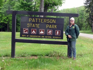
My first stop of the day was Patterson State Park and I was happy to find the sign has been replaced.  So happy, in fact, that I bounced out the VW to trek across the lawn toward the sign before remembering to change my shoes thus my shoes AND socks were soaked.  My next stop , Prouty Place State Park is another small park with rustic camping.  I sat next to the stream here and changed into dry socks and shoes, placing my wet socks on the car’s dashboard in hopes they may dry.  Leaving Prouty Place, I detoured to visit the remains of Austin Dam in Austin, PA.  This place had been written up in Mountain Home Magazine last year as they celebrated an anniversary and I wanted to see it.  The dam and the remains of the Bayless Paper Mill are both interesting places worth a boondoggle!

After turning in the wrong direction and having an argument with my GPS, I finally made my way to Sizerville State Park where I visited the Nature Center, got a free box of Grape Nuts and ate a snack.  The camp ground was beginning to fill up even though the forecast for the entire weekend did not call for warm weather.  After being extirpated in the state, a pair of beavers was reintroduced in Pennsylvania near this park in 1917 and beavers are still found in the area.  After leaving Sinnemahoning I drove through Bucktail State Park Natural Area where I was fortunate to find a sign next to a safe pull-off where I could snap the photo.  In the photo I am kneeling in attempt to cover some graffiti on the guiderail.  In Emporium I stopped at the Elk State Forest office and gathered some park & forest maps I was missing.  After leaving Emporium I stopped at beautiful Wayside CCC Memorial picnic area then later at an interesting coal display outside the Little Museum of Cameron County.  I enjoy traveling alone as I can stop when I feel like it, turn around whenever I miss something I don’t want to and I don’t have to worry about pleasing anyone but myself (no one heavy sighing in the passenger seat when I pull off the road unexpectedly is nice too!)

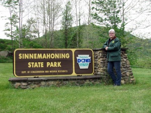
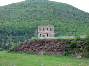
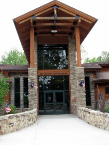
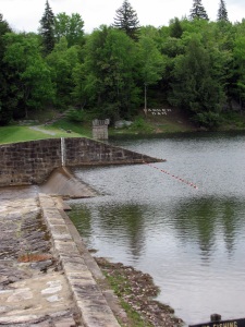
My next stop was Sinnemahoning State Park and I entered the park near the George B Stevenson dam.  Some time prior to this trip it dawned on me that I had seen a lot of dam parks so I’ve been keeping a log as to who built the dam, who owns & operates the dam and any historical significance of the dam.  Sinnemahoning has a gorgeous Wildlife Center where I was surprised to learn that the Monarch butterflies flock to this valley every fall and coat the trees with their orange & black prior to their long flight to Mexico.  I walked around a bit near the park office and discovered evidence of a recent wedding.  It seems like weddings in PA state parks are the thing to do!  On my way toward my next park I drove through Driftwood and stopped to look at the statue commemorating the Pennsylvania Bucktails.

When I entered Pennsylvania’s Elk Country I stopped at Hicks Run Wildlife viewing area but saw no elk or any other wildlife for that matter.  Sun set was about two hours away but I hadn’t time to wait – this stop was not on my list and I was losing daylight. Regardless of the timing issue, I drove up to the PA Elk Country Visitor Center and once there, I knew I would have to return to this area with Matt – there was just too much to see and do in the short amount of time left in the day.  From the Elk Visitor Center, Parker Dam State Park was a short drive and in the Moshannon State Forest.  Multiple tornadoes tore through this region of the state in 1985 and the interpretive displays near the octagonal CCC cabin are very interesting.  The CCC Museum near the dam was closed, much to my disappointment.  Again, I wanted to linger here longer but nightfall was approaching but I had miles to go before I sleep…

Simon B Elliott State Park is a few miles from Parker Dam and not far from I80.  When I stopped at SB Elliott I had very little day light remaining but enough to drive through the small camp ground and around the day use area.  By the time I hit I80 a few minutes later I had to turn on my headlights.  I stopped at the very next exit to grab a quick bite in a drive-through then got back onto I80 heading east.  I had a room waiting for me at my last park of the day and the only park in the system with a bed and breakfast.

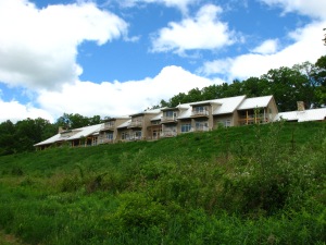
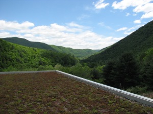
The sign for Bald Eagle State Park was easy to miss in the dark and I ended up driving the length of Foster Joseph Sayers Lake before phoning the Nature Inn for directions (and to assure them I was on my way) and turning around.  After unloading the VW and carting all my stuff into the Inn, I was anxious to relax. And again, I knew I had to return to this beautiful place for one night would surely never be enough.  The building is LEED Certified Green and I could write an entire journal about the Nature Inn at Bald Eagle and everything I liked.  The following morning I enjoyed a great breakfast buffet before taking a hike. It was cold and I wore a wool jacket over a sweater & long sleeved shirt!  It was a gorgeous morning and a vast difference from the overcast, rainy day before.  When I returned from my hike it was time to check out so I loaded the VW and just before leaving an Inn employee helped me to spot the nesting bald eagles across the lake.  I hit the road once again with only one more stop before coming home.

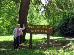
I had missed Upper Pine Bottom State Park on Tour #4 and this trip offered the perfect opportunity to add this park to my ever-growing list.  Before reaching this small day-use park I stopped at the Tiadaghton Forest Office in Waterville and was blown away with their interpretive displays, their building and the view of Pine Creek Gorge it offers.  My main reason for stopping was to use the toilet so all this was an added bonus!  Just up the hill from the forest office is Upper Pine Bottom, bringing my total number of parks to forty-one.  I drove through Little Pine SP and was fortunate to see more nesting eagles.  Further up Route 287 in English Center is a very interesting bridge that I was asked to answer questions pertaining to by a State Highway Department worker on one side of the bridge and I got out on the other side to take photos.  By the time I reached home I had just enough time to unload the car, shower & dress quickly for the memorial service.  Tour done!

a1_YellowThroatPatterson 2013_05_24Prouty Place 2013_05_24a4_ProutyIMG_0391 a6_Baylessa7_AustinDamSizerville 2013_05_24IMG_0414 MOD IMG_0417Bucktail 2013_05_24a10_WaysideCCCIMG_0430 moda12_CamCtyCoalIMG_0435Sinnemahoning 2013_05_24IMG_0440 modIMG_0448a13_WildlifeCtrIMG_0450IMG_0454  a15_BucktailElk State Forest 2013_05_24a16_HicksRunPlatformIMG_0456IMG_0458a18_ElkVisitorCtra19_ElkBronzeIMG_0471 modParker Dam 2013_05_24IMG_0477Moshannon State Forest 2013_05_24a20_ParkerDam  IMG_0482                    SB Elliott 2013_05_24Bald Eagle 2013_05_25          a_Bird1  a_BumbleBee a_SwallowTail1 a_SwampOak a_TreeGroup  IMG_0533 IMG_0562 IMG_0579 IMG_0591IMG_0586 IMG_0589 Upper Pine Bottom 2013_05_25a_UPBSP IMG_0595 IMG_0597 IMG_0599

Tour #6 – Four Parks, One Day

After my day in the forest in April 2013 I planned my next tour for Memorial Day weekend to coincide with “A Day In The Life Of A Park” event.  I have a four-day weekend for Memorial Day and this would be my first tour alone.

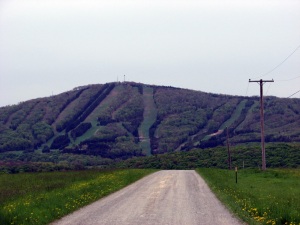
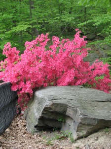
Before I reached that weekend, Matt had a weekend off and I convinced him to take a day tour with me to a few parks I had scoped out.  I programmed the GPS to “least use of freeways” and headed out toward Binghamton then south.  The drive to the first park seemed to be endless and after looking at the map to see the route we took, I understand why. We passed Elk Mountain Ski Resort and marveled at the slopes in the spring foliage.  Prompton State Park is a small day-use park at Prompton Lake whose dam is operated by the Army Corps of Engineers.  The weather was not so great this day and we saw no one enjoying the park.  From Prompton we drove further over hill and dale to visit Varden Conservation Area, one of the newer parks in the system even though its name does not contain the words “state park.”  From Varden we drove to Archbald Pothole State Park and somewhere along the way drove through an area with A LOT of wind mills on the surrounding hills.  Archbald Pothole, a day use only park, is stunning in May with the azaleas in full bloom and became another park on my “must see” list.

After visiting APSP we drove to through not enough forest land and too much highway and city for me to get to Lackawanna State Park.  We checked out the camp ground and the rest of the park and I was pleased to see a number of people in the park and once again jealous because I have to drive so far to get to a PA park!

After leaving Lackawanna I drove up Route 11 to show Matt the Nicholson Railroad Bridge.  I had visited this site once before on a trip home from the Philadelphia/NJ area many years ago.  On this trip I found there is a very nice park where you can safely park and get out to see the bridge better.  We were fortunate enough to see a train crossing the bridge while there.

Home after dinner in Vestal with thirty-three parks checked off the list to date.

Elk MtnPrompton 2013-05-18IMG_0318Varden 2013-05-18IMG_0320Archbald Pothole 2013-05-18    Archbald Pothole 1 Archbald Pothole 3  IMG_0323 IMG_0324 IMG_0328 Lackawanna 2013-05-18IMG_0350  Lackawanna Kayaker Tunkhannock Viaduct With Train IMG_0360

An Invitation To The Forest

I began 2013 with a promise to myself to see more parks in the year to come.  I joined the Pennsylvania Parks and Forest Foundation after receiving their email newsletters years and purchasing the PA State Parks & Forests Passport book.

My first foray into the forest was in mid-April and not a time I would normally be compelled to visit a park or even less so, the forest.  The reason was for “A Day In The Life Of A Forest” event set forth by the PA Parks & Forest Foundation.  The date chosen was close to the birth date of Joseph Rothrock, Pennsylvania’s Father of Forestry.

I selected Tioga State Forest as it is the closest Pennsylvania State Forest to my home.  I had previously visited the forest unplanned last fall with Diane and attempted to locate Fallbrook Falls and/or County Bridge Park. Without my directions and map, we went elsewhere and found a beautiful swimming hole the locals call Pirate Rock near Blossburg.

This day in April I visited County Bridge Park first and it happened to be the opening day of trout season in Pennsylvania so the anglers were out.  There were even a few campers in the camp ground although it was still quite cold at night and not very warm during the day! The Tioga River originates up here on this hill near County Bridge.  Down river further, toward Blossburg you can still see the orange effects of the acid drainage caused by the long gone coal industry.

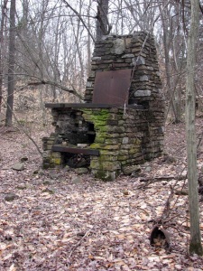
From County Bridge I found Fallbrook Falls and the remains of its bygone picnic park.  There was a town named for the falls long ago during the Blossburg coal era.  The railway from here to Corning  was named Fallbrook RR; the railroad’s roundhouse area became the former Fallbrook Plant owned by Corning Incorporated (Corning Glassworks) and now a park covers the area, Fallbrook Park.  I am told you can easily find coal in the Fallbrook Falls area but this day the water was rushing and I had no desire to wander too far off the trail alone.  Instead I wandered back beyond what appeared to be an old pavilion foundation and further into the woods.  The large stone cooking stove I photographed was an odd find – I am not sure if I was in the forest or on private land but it is reminiscent to other CCC-built stone fireplaces I have seen.

Being out in the forest was a wonderful way to re-energize my spirit after the long winter and something I should remind myself to do every year.

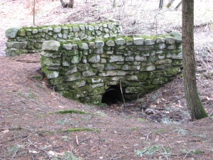
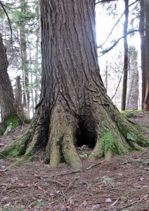
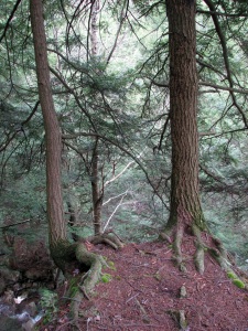
CountyBridgeAngler with Trout IMG_0084Catkin  IMG_0202Hole in a Tree   Hemlock Cliffhangers Reflections Furnace

One Park, One Day

Life has a way of changing and in April of 2012 I received a phone call that turned into a full time job.  I had not worked full time in almost ten years and was certainly ready to get back but had not been able to find anything suitable & full time.  Working comes with its pros (income) and cons (loss of personal time) and I had a difficult time achieving a good balance for a while.  For this reason I did not do any multi-park tours in 2012.

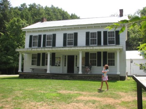
In early August I invited my friend Diane to visit a park below the Binghamton area and not a long drive from home.  We visited Salt Springs State Park and spent the hot summer day hiking and otherwise investigating the park.  The park is adjacent to 300 acres owned by the Friends of Salt Springs State Park who operate the camp ground & cabins and a small museum and gift shop in the historic house on the property.

Upon arriving at the park it was clear that a wedding was about to start, making this the second state park wedding I have seen (and both with Diane.) The wedding party had photos taken in the stream, creating a lovely backdrop.

Hiking the stream proved to be a bit more difficult than we were up for but we walked along a lovely trail that included some boardwalk through forest and found Penny Rock which is really cool but neither of us had any pennies.

And in case you are wondering: Yes, there is a spring that bubbles salt water at the park, I tasted it just to be sure!  This day we watched while a man performed an experiment for his young son by capturing & igniting the methane that bubbles out of the salt spring – taking the opportunity to learn from nature – VERY cool! The history of the spring is also very interesting but you’ll have to visit the park (or DCNR web site) to learn more.
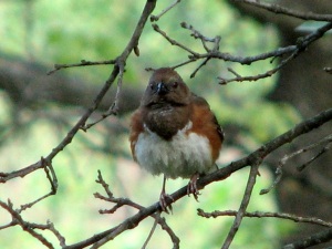
Salt Springs 2012-08-04 a_SaltSPring2 a_SaltSpring3 a_SaltSpring4 IMG_0345 IMG_0353 Modified

Tour #5 – With My Best Travel Companion

About a month after my tour with Diane, my husband Matt and I left home on the two-day PA State Park Tour #5.  The first park we visited this day was Shikellamy State Park along Route 15.  I had visited this park many years ago as a child with my very good friend Katie (who grew up in Elmira) and her mother’s family.  That day we picnicked at the upper park overlooking Northumberland and I remember being fascinated with the charcoal pits where the hot coals were to be placed after cooking.  Those charcoal pits are still there and I have seen them in other parks as well although they don’t hold the same fascination for me any longer.  On this trip we visited the upper park and enjoyed the view on a clear August day.  When we left Shikellamy I had to retrace our path as I had forgotten to get off the highway in Milton on our way down.  Milton State Park is located along the Susquehanna River and is a day-use only park.  I used the bathrooms which were fairly new and in great condition (as is the general condition of every state park bathroom I have used!)

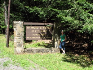
Leaving Milton and heading to our next park was a welcome change in scenery and pace as we got off highways and eventually drove into state forest land.  Sand Bridge State Park is another day-use only park yet proved to be a lovely spot with a babbling brook, lush greenery, a new pavilion and bathrooms.  It seems as though there has been some recent efforts to upgrade most day-use parks’ bathroom facilities.  Not too far from Sand Bridge is Raymond B Winter State Park where we had hoped to camp.  After driving through the camp ground twice, I decided to drive the short distance to Ravensburg and set up camp there.  Along the route to Ravensburg we passed a Bald Eagle State Forest office and snapped a photo.  With only 12 camp sites at Ravensburg, we fully expected to be alone at the camp ground however a group of volunteers was gathering there for a weekend of trail clean-up on the Mid-State Trail.  This was the first time Matt had camped with me in my tent and the excursion would have been non-noteworthy had Matt not disturbed a nest of ground bees while chopping fire wood.  He got stung a number of times but luckily I found one Benadryl in my purse that relieved his pain.

The following morning after packing up we drove from Ravensburg to RB Winter and in between we found McCall’s Dam State Park where there is no park sign and no dam!  We had driven past the park the day before but without a sign of any kind I wasn’t convinced where I was.  Having no sign made it rather difficult to determine where to take the photo of proof and I really ought to leave this park on my list for a future visit with hopes for a sign.  It was a beautiful day when we reached RB Winter and we spent some time investigating the park.  We agreed we would like to return to here in the future with our camper.

The drive from RB Winter to our next park was a long drive over hills and into valleys and through lush state forest land.  By the time we reached Poe Valley State we knew we were running short on time but the beautiful sight of the lake and the new bath house were enough to make us want to linger.  This park is high on a hill far from everything and very peaceful.  Poe Paddy State Park is a few miles from Poe Valley and has a rustic camp ground.  We did nothing more than drive through the park in effort to make it to our last park of the day and have our evening meal.

At Reeds Gap State Park we set up our small grill in the picnic area and made a quick, hot meal to re-energize ourselves.  The map I had (outdated) indicated a swimming pool at Reeds Gap but it had since been removed and the old bathhouse was still standing unused.  We determined the pool must have been old and rather than replace it, the DCNR put the money into upgrading facilities at Poe Valley a few miles away.

When we left Reeds Gap I decided to travel toward State College to come home and we drove through some beautiful farm country.  One town we passed through had the narrowest main road I have ever seen with barely room for a sidewalk between road & house/building.  You could easily imagine the town in the days before the automobile.  We also saw the “dotted roadway” near State College which I found very interesting.  If you’ve never driven near State College these large white dots on the road are meant to keep you at a safe distance from the car ahead of you in this hilly region where it’s difficult to see far ahead and traffic congestion is a real concern during certain hours of the day.

Home with twenty-eight state parks and five state forests checked off my list.

Bald Eagle State Forest 2011-08-11 McCalls Dam 2011-08-12 Milton 2011-08-11 Poe Paddy 2011-08-12 Poe Valley 2011-08-12 RB Winter 2011-08-11 Reeds Gap 2011-08-12 Sand Bridge 2011-08-11 Shikellamy 2011-08-11Matt at Sand Bridge The View from Shikellamy Lookout The marina - Lower Shikellamy SP Northumberland, from Shikellamy Lookout


Tour #4 – Repeats And Further

In mid-July 2011 I planned a tour with my friend, Diane, which included an overnight stay at one park with pet camping as she wanted to bring along her dog.  This was the first tour I planned where I was not the driver so I looked forward to being able to really enjoy the scenery for the entire trip!

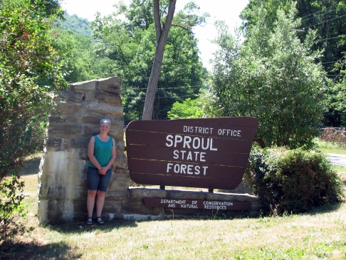
After loading Diane’s Rav4 the evening before, we headed out early in the morning with our first stop being Ole Bull State Park once again so I could get the photo.  From Ole Bull we headed south to Kettle Creek State Park, NOT missing the turn this time!  We did not spend any time in either park as I had already visited both on Tour #1 with Matt.  After leaving Kettle Creek we stopped at the Sproul State Forest office to snap a photo and then I felt like I was on a new adventure with only new parks and forests ahead.

Hyner Run State Park was the next stop on our tour.  We drove through the camp ground and stopped in the picnic area to eat lunch and walk the dog.  Hyner Run has a swimming pool and there were a lot of folks using the swimming area on this warm day.  Just above Hyner Run is Hyner View State Park, a must-see park in the system.  I had been told about this park a few years ago by a woman who rides a Harley who had been there on a group bike run.  On a clear day the view is phenomenal.  There was a wedding about ready to begin this day and the wedding party and most of their guests had arrived via Harley Davidson motorcycles.  Hyner View has a similar bronze statue as Leonard Harrison, this one honoring the forest fire fighter (LHSP statue is a CCC worker.)

Leaving Hyner View we drove past the Tiadaghton State Forest office so stopped to take a photo here.  The word Tiadaghton means…  Our next destination was a small park that was inaccessible due to a bridge being out so we headed to the park where we had camping reservations, Little Pine State Park.  Little Pine is near the Pine Creek Rail Trail and Waterville.  My sister’s husband co-owns some property not far from Waterville so I had driven past Little Pine before.  This day we really hadn’t much more time than enough to set up camp, get a bite to eat a restaurant conveniently located just outside the park and build a fire before calling it a night.  The dog, who was brought along because it was thought he would enjoy the outing, really seemed to dislike the camping portion of the tour!

The next morning we left Little Pine and headed to the next park just above I80.  Ravensburg State Park is a small park with two nice picnic pavilions and rustic camping – meaning no electric sites, no showers.  From Ravensburg we were supposed to drive below I80 to our next park.  When the Rav4’s gas light came on in the middle of farm country with no gas station within 30 miles, we turned back to Jersey Shore by which time I had lost my patience with not having control over the decision-making that goes along with being the driver.  We skipped 4-5 parks that were on my list for this tour and instead headed directly to the Williamsport area where we visited Susquehanna State Park.  Located along the Susquehanna River, this park’s highlight is the Hiawatha paddle boat.

From here it was a rather straight shot home up Route 15, with nineteen state parks and four state forests checked off my list.

Image

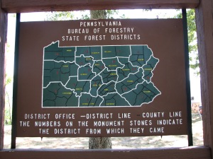
ImageImageImageImageImageImageThe Hiawatha - Susquehanna State Park Someone would rather be home... Forest Fire Fighter Status - Hyner View Forest district map - Hyner View The view from Hyner View Hyner View Forest Fire Fighter Statue Kettle Creek

Tour #3 – Driver’s Choice

Early in July 2011 Corinne and I had just returned from a few days in the Adirondack region. I like returning home from the Adirondack region about as much as I like returning home from a visit to a Pennsylvania state forest/park.  It was Saturday morning and Corinne was up for a boondoggle so we headed off to the Pine Creek Natural Area and the state parks that overlook the valley below.  She had never seen the gorge so visiting Leonard Harrison State Park was a genuine treat for us both.  I was pleased to find the park much improved from my last visit in the 1980’s.  Leaving the east rim, we drove to the west rim to visit Colton Point State Park which remains rustic and reminiscent of the CCC men who built it.

A public works program created in the 1930’s as a way to ease nation-wide unemployment, the Civilian Conservation Corps (CCC) was a cooperative effort between the Departments of War, Agriculture, Interior and Labor.  At the height of the program there were 136 CCC camps in Pennsylvania – 96 on State Forest lands.  The number of camps was second only to California with 155 camps.  Beyond a doubt, this was the most beneficial, most enduring public works program ever created in the US.

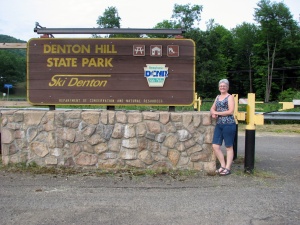
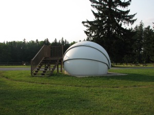
This was about as far as Corinne was anticipating travelling that day but I convinced her that the next park was “just a few miles away.”  We eventually reached Lyman Run State Park which had its dam rebuilt just a few years earlier.  Even though she kept telling me the GPS said to turn around and go home, I insisted we continue through the Susquehannock State Forest to Cherry Springs State Park, possibly one of the coolest parks in the system. This park is located in one of the darkest spots  around here and is used by astronomers both amateur and professional.  A few times each year visitors can join a “Star Party” with a local astronomy group. I continued driving westward, reaching Cherry Springs long before night fall and too early to truly appreciate the star gazing field.  Just down the road from Cherry Springs is a small park named Patterson State Park.  The sign was missing on this trip so I had to leave the park on my list so I could revisit another time in hopes the DCNR may replace the sign.  Not far from Patterson is another small park that Corinne was in no way interested in visiting that day so we headed north to Route 6 then east toward Wellsboro.  Fortunately Denton Hill State Park is on Route 6 so stopping at this last park of the day for a quick photo was almost effortless.

The town of Galeton was having their fireworks show this evening and getting through that area on Route 6 proved to be a bit challenging with all the folks pouring into town for this annual event.  East of Galeton I was pulled over by the Galeton cop for driving over the speed limit but he was nice enough to let me off with a warning.  Thank you, officer whateveryournameis.

Tour #3 ended with 12 (or 13) parks and two state forests checked off and enjoying my progress!

Cherry Springs 2011-07-02 Colton Point 2011-07-02 Denton Hill 2011-07-02 Leonard Harrison 2011-07-02 Lyman Run 2011-07-02 Patterson 2011-07-02 Susquehannock State Forest 2011-07-02 IMG_0224 IMG_0230 IMG_0235 IMG_0238 IMG_0248 IMG_0257 IMG_0269

Where It’s Close to Home

My friend Megs and I made a trip to Wellsboro on Veterans Day in 2010 to take in some holiday shopping.  On the way home we drove up to Hills Creek State Park to have my photo taken.  Seeing the park in the waning light of a cold, bleak November afternoon was far from what I remembered of the park from my first visit.  Hills Creek is the closest PA State Park to my home in the Central Southern Tier of New York State.  I took Corinne there sometime around 2003 on a hot summer day to enjoy the free swimming in fresh water but have not returned other than this day.

Seven parks checked off.

Hills Creek 2010-11-11

Where It Feels Like Home

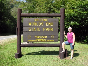
As in each previous summer, Corinne and I camped a few nights at Worlds End State Park in August 2010.  When I first began tent camping alone with my daughter we tried out another park closer to home but never felt the comfort feeling we both get from WESP.  From 2002 until 2011, the two of us made at least one camping trip to WESP in one tent or another.  We have stayed in a number of sites and have discovered our favorite tent (and now camper) site in the park.  With each visit we make the drive to Canyon Vista and the Rock Gardens then farther out into the Loyalsock State Forest to High Knob Overlook.  With each year I am discovering more of the Loyalsock Forest and will continue to call WESP my “home park.”

Worlds End became my sixth park sign photo and the Loyalsock Forest sign photo was my fist state forest pic.

Worlds End 2010-08-31 Loyalsock State Forest 2010-08-30

Tour #2 – The Journey Begins

For a few days in mid-August 2010 we were fortunate to be able to use a Keuka Lake cottage owned by some friends.  We live very close to New York’s Finger Lakes region and have spent a number of summer vacations “at the lake.”  Prior to leaving day, my daughter Corinne and I planned a tent camping trip to Cook Forest State Park in western Pennsylvania.  She & I had driven through the park in 1999 during a camping trip in the Allegheny National Forest and the park was high on my list to visit.

Tour #2:  We left home and traveled west on Route 17 to Route 219 where we headed south to Bradford PA then wound our way down to the park.  When we reached Cook Forest we had no problem finding an open camp site, which in hindsight taught me a lot about taking the time to properly scope out a “good” tent site.  We spent a lot of time in the park hiking the trails, wading in the Clarion River and visiting the fire tower.  Corinne readily climbed the tower twice to soak in the awesome view while I gladly waited below.  The highlight of Cook Forest is the Forest Cathedral, some of the oldest growth forest east of the Mississippi River and a National Natural Landmark.  The park is beautiful as is the surrounding countryside.

On the third evening we had severe storm warnings and all the tent campers were on high alert.  During the night we had torrential rain and in the morning there was a veritable lake between the bottom of my tent and my ground cloth as I had selected a site on a downside slope.  If you’ve ever camped in a tent and awoken the next morning to everything being damp or worse yet, wet; your shoes get wet just walking around and starting a fire seems almost impossible… it was one of those mornings.  I woke Corinne; we climbed in the car and headed out for breakfast at Farmers Inn.  This place seems to be out in the middle of nowhere but having eaten dinner there our first evening in the park, we knew it was worth the trip.

After our breakfast meal the weather was still damp, foggy and overcast so we visited nearby Clear Creek State Park.  The park’s camp ground is small but was close to, if not full of campers.  I was fascinated with the disc golf course and the soft green lawns along the calm rolling creek were idyllic on the misty day.  For some reason I neglected to have my photo taken next to a Clear Creek State Forest sign so a return trip to the area is in my future.

On the way home from Cook Forest, we traveled a lot of back roads and along the way visited Bendigo State Park which was empty except for the folks working in the park office.  From there we traveled even more back roads to find Elk State Park which surrounds  East Branch Lake.  The Army Corps of Engineers (ACE) operate a camp ground near the dam.  The Elk State Park I discovered consisted of a large boat launch area that was extraordinarily eerie due to fact that the lake level was down and the launches were not usable.   Again the park was empty of people.  To get to the park we passed through Johnsonburg, PA which is home to a large paper mill and thus can be a very stinky place.  That day it was awful and Corinne named the town “Godfart.”  From Elk we drive north to visit Kinzua Bridge State Park.

Matt and I had visited Kinzua Bridge State Park rather by accident in 1999.  On our return trip from the Allegheny National Forest camping trip we got a flat tire on our trailer which was being used to haul 2 ATV’s.  It was a holiday Monday and we could not find an open store to get a new tire or have ours repaired so we resorted to calling AAA and the trailer (and 1 ATV) were taken to Mt Jewitt, PA while we returned home.  The following day Matt and I drove back to Mt Jewitt and discovered Kinzua Bridge State Park.  In 1999 the bridge was still standing and trains were still using it, if not just for tourists.  Matt walked out onto the bridge that day while I stayed safely on the soil at one end.  In 200? While a work crew was working on the bridge, a tornado tore through the valley and left only a portion standing.  When we visited in 2010 there were again crews working on the remaining structure building today’s skywalk.  To see the twisted piers tossed upon the valley floor below was an awesome sight.  The state has done a wonderful job building observation decks and providing interpretive displays about the bridge’s history and tornado.

We came home with five state parks crossed off my list and more than one hundred to go.

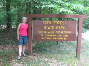
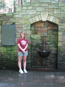
Me with Cook Forest State Park Sign Corinne at Cook Forest Cook Forest Fire Tower

Tree roots over solid rock at Seneca Point Overlook, Cook Forest SP.

Tree roots over solid rock at Seneca Point Overlook, Cook Forest SP.

The interesting rocks at Seneca Point Overlook, Cook Forest SP.

The interesting rocks at Seneca Point Overlook, Cook Forest SP.

Coriinne with a HUGE tree root

National Natural Landmark marker in the Forest Cathedral.

National Natural Landmark marker in the Forest Cathedral.

Corinne at Cook Forest State Park